The Municipality lies between longitudes 10 49’East and 20 30’ West and latitudes 80 00’ north and 70 35’ South. The Municipality shares common boundaries with Wenchi Municipality to the North and West, Kintampo south District to the North-East, Nkoranza South District to the South-East and Offinso-North District (in the Ashanti Region) to the South. Total land area is 669.7 square kilometer.
The Municipality has a high population with an estimated of 244,977 (projected 2010) and also with population growth rate of 3.84% with a population density of 343 people per square kilometer (Projected, 2010)
Climate
The Techiman Municipality experience both semi-equatorial and tropical conventional or savanna climates, characterized by moderate to heavy rainfall annually.
The major rains start from April to July and the minor from September to October, then the only dry season which is highly pronounced in the savanna zone, starts in November and lasts until March.
The highest rainfall of over 1650mm is recorded in the south-west and declines northwards to about 1250mm in the North West Guinea-savanna zone around Offuman area. It has annual average temperature of 280C and a relative humidity of 75-80% in the rainy season and 70-72% for the rest of the year.
Vegetation
The Municipality has three main vegetation zones, namely, the Guinea-Savanna woodland, located in the north-west, the semi-deciduous zone in the south and the Transitional zone, which stretches from the south-east and west up to the north of the municipality.
SOILS
There are three major soil associations in the Techiman Municipality, namely:
a. The Damango-Murugu-Tanoso Association
b. The Bediesi-Bejua Association; and
c. The Kumasi-Offin Association
AGRICULTURE
Land Use
The major land use areas are crop production and animal production. Aquaculture is on the traces and small fraction under reforestation joining Asubima Forest Reserve
CROP SECTOR
Techiman is noted with the largest market in the sub-region. It hosts traders from Togo, Benin, Cote D’ivoire, Burkina Fasso, Mali and therefore is an International Market.
Major crop performance in 2009-2010
| Comparative Production Figures (2009-2010) | |||||||||
| Crop | Area Cropped (Ha) | Average Yield (Mt/ha) | Production (Mt) | ||||||
| 2009 | 2010 | % Change | 2009 | 2010 | % Change | 2009 | 2010 | % Change | |
| Maize | 15,230 | 15,690 | 3.00 | 1.90 | 2.09 | 10.00 | 28,937 | 32,792 | 13.32 |
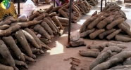
| Cassava | 8,680 | 10,420 | 20.00 | 16.51 | 17.75 | 7.50 | 143,324 | 184,955 | 29.05 |
| Yam | 13,230 | 13,630 | 3.00 | 21.49 | 20.85 | -2.98 | 284,35 | 284,186 | -0.05 |
| Cocoyam | 2,970 | 2,710 | -8.80 | 7.23 | 6.14 | -15.02 | 21,460 | 16,639 | -22.46 |
| Plantain | 8,120 | 7,960 | -2.00 | 10.61 | 10.08 | -4.97 | 86,135 | 80,237 | -6.85 |
| Tomato | – | 4,780 | – | – | 11.5 | – | – | 54,,970 | – |
| Pepper | – | 1,370 | – | – | 1.70 | – | – | 2,329 | – |
| Garden Eggs | – | 210 | – | – | 8.1 | – | – | 1,701 | – |
| Groundnuts | – | 580 | – | – | 0.90 | – | – | 522 | – |
| Cowpea | – | 820 | – | – | 1.1 | – | – | 902 | |
SRID/RADU-2010
LIVESTOCK/POULTRY POPULATION (HEADS)
| Year | Cattle | Sheep | Goat | Pigs | Poultry |
| 2007 | 6,355 | 19,404 | 18,091 | 3,928 | 65,000 |
| 2008 | 6,983 | 24,000 | 21,786 | 4,365 | 82,000 |
IRRIGATION FACILITIES
1. Tanoso irrigation covers 96 Ha
2. Kokroko small Farmer irrigation project – 66Ha
3. Kaniago small Farmer Irrigation project-65Ha
Hectares of degraded forest rehabilitated under Reforestation Programme –Asubima Forest.
| Year | Hectarage |
| 2005 | 1,750 |
| 2006 | 2,500 |
| 2007 | 1,000 |
Agricultural Projects
1. Tomato Processing Promotion Centre (TPPC)
2. Cocoa Disease and Pest Control Programme (CODAPEC)
3. Root and Tuber Improvement and Marketing Programme (RTIMP)
4. Cassava Adding Value, Africa (CAVA)
5. African Cashew Development Initiative (ACDI)
6. Community Forestry Management Project (CFMP)
 http://mofa.gov.gh/site/wp-content/uploads/2011/07/A-tomato-fields-belonging-to-2009-National-Best-Tomato-Farmer-Ofuman.jpg 435w" sizes="(max-width: 300px) 100vw, 300px" style="border: 0px; margin: 0px; font-family: Tahoma, Geneva, sans-serif; vertical-align: baseline; line-height: 18px; outline: 0px; padding: 0px; width: 310px;">
A tomato fields belonging to 2009 National Best Tomato Farmer- Ofuman
 http://mofa.gov.gh/site/wp-content/uploads/2011/07/A-block-Farm-Field-at-Ofuman-–Techiman2.jpg 432w" sizes="(max-width: 300px) 100vw, 300px" style="border: 0px; margin: 0px; font-family: Tahoma, Geneva, sans-serif; vertical-align: baseline; line-height: 18px; outline: 0px; padding: 0px; width: 310px;">
A block Farm Field at Ofuman –Techiman
 http://mofa.gov.gh/site/wp-content/uploads/2011/07/Processing-Unit-–Tomato-Processing-Centre-Techiman.jpg 431w" sizes="(max-width: 300px) 100vw, 300px" style="border: 0px; margin: 0px; font-family: Tahoma, Geneva, sans-serif; vertical-align: baseline; line-height: 18px; outline: 0px; padding: 0px; width: 310px;">
Processing Unit –Tomato Processing Centre-Techiman


