The district covers a land area of 1,996km2 with an estimated population of 65,253 as at the year 2000. This has been projected to be 82,109 in 2009.
GEOLOGY AND SOIL
Soils in the District range from fine sandy loams to clayey loams and are mostly poorly drained.
VEGETATION
The District falls within the interior wooded savanna or tree savanna. It is believed that the transitional zone was once forested and that the savanna conditions currently prevailing have been the result of human activities especially charcoal production and persistent annual bush fires
WATER SUPPLY
Wells constitute the main source of water in the District (89%), followed by bore holes (11%). Only 70 bore holes are currently in use. The type of rock which underlies the District has a negative influence on the underground water resources. Consequently, most bore holes and wells get dried up in the dry season.
AGE AND SEX DISTRIBUTION OF THE POPULATION
The district has an estimated population of 65,253 as at the year 2000. The population is dominated by males (51.7%). This could be partly due to the continuous influx of mostly male settler farmers from Northern Ghana into the District
SEX AND RURAL URBAN DISTRIBUTION OF THE POPULATION
About half of the population (45%) resides in the only two urban settlements of the district, namely Atebubu and Amantin. Atebubu alone commands about 84.6% of services and facilities of the District.
LABOUR FORCE
The district has a large labour force constituting 55.8% of the population. Though the dependent population is quite high(44.2%), their effect on the active population could be lower since most of those in the senile age group could still be engaged in one or other form of the agricultural production.
AGRICULTURE
Agriculture is the mainstay of the Atebubu Amantin District economy employing about 70% of the economically active labour force. Farming in the District is largely carried out on small-scale basis. The average acreage cultivated ranges between 4 and 6 acres for all crops. Despite its importance in the district’s economy, much of the agricultural potentials in the District remain unutilized. For instance, out of a total of 22,261 hectares of arable land, only 3,167.6 hectares is currently utilized. The District’s irrigation potential is also untouched and as a result farming activities are brought to a halt during the dry season.
CROPS
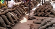
The major crops grown in the District are maize, yam, vegetables (garden eggs, okro and pepper) rice, cassava, groundnut and cowpea. However, crops such as plantain and sorghum are also cultivated in some parts of the District but are not on a large scale when aggregated. With respect to tree crops, Mango is gaining popularity in the district.
| PRODUCTION FIGURES-2010 | |||||||
| CROP | MAIZE | RICE | SORGHUM | CASSAVA | YAM | G/NUTS | COWPEA |
| Area Cropped (Ha) | 1,690 | 260 | 150 | 20,790 | 10,720 | 1,420 | 490 |
| Yield (Mt/Ha) | 2.20 | 1.90 | 1.10 | 13.33 | 16.41 | 1.50 | 1.30 |
| Production (Mt) | 3,718 | 494 | 165 | 277,131 | 17,915 | 2,130 | 637 |
LIVESTOCK
The major animals kept in the district are cattle, sheep, and goats. Pigs and fowls are also kept by a few farmers
PROJECTS
| Project | Start Time | End Time | Achievements |
| Livestock Development Project (L.D.P) | 2003 | 2010 |
|
| Inland Valley Rice Development Project (IVRDP) | 2004 | 2010 |
|
| Root and Tuber Improvement and Marketing project(RTIMP) | 2008 | 2015 |
|
| NERICA Rice Dissemination Project | 2008 | 2011 |
|


