FOREWORD
FOR YOUR PIGS, POULTRY AND POULTRY PRODUCTS VISIT THE MUNICIPALITY.
 http://mofa.gov.gh/site/wp-content/uploads/2011/06/EJISU-JUABEN.jpg 687w" sizes="(max-width: 300px) 100vw, 300px" style="margin: 0px; vertical-align: baseline; line-height: 18px; outline: 0px; padding: 0px; width: 732px; max-width: 100%;">
 http://mofa.gov.gh/site/wp-content/uploads/2011/06/EJISU-JUABEN-2.jpg 697w" sizes="(max-width: 300px) 100vw, 300px" style="margin: 0px; vertical-align: baseline; line-height: 18px; outline: 0px; padding: 0px; width: 732px; max-width: 100%;">
INTRODUCTION
Ejisu- Juaben Municipal is Located 20 km from Kumasi on the Kumasi-Accra highway. It is one of the 27 administrative and political Districts in the Ashanti Region with Ejisu as its capital.
LAND LOCATION AND AREA
The Municipality is located in the central part of the Ashanti Region and shares boundaries with six (6) other Districts in the Region namely Kumasi, Kwabre, Afigya Sekyere, Asante Akim north, Asante Akim South and Bosomtwi Kwanwoma Districts. It lies within latitude 1.15˚N and 1.45˚N and longitude 6.15˚W and 7.00˚w.
The Municipality stretches over an area of 637.2 km₂ constituting about 10% of the entire Ashanti Region. The strategic location of the Municipality (especially the capital Ejisu, which lies only 20 km from Kumasi and the other communities along the Kumasi-Accra trunk road offer a lot of potentials that foster development of marketing activities along the road sides and the diffusion of information and innovation.
TOPOGRAPHY AND DRAINAGE
The Municipality falls within the forest dissected plateau terrain region. This region is underlain by the pre-cambrian rocks of the Birimian and Tarkwaian formations. It rises from about 240 metres to 300 metres above sea level. The area is generally undulating and is drained by a number of rivers, notable among them being Oda, Anum, Bankro, Hwere and Baffoe. In the rainy season, occasional flooding is experienced in the inland valleys along the river basins. The construction of a dam on the Anum River at Nobewam for irrigation offers a great potential for agricultural development in the Municipality.
CLIMATE AND VEGETATION
As in the case of most of the middle belt in Ghana, the municipality experiences tropical rainfall that is bi-modal rainfall pattern and wet semi-equatorial climate. It is characterized by double maxima rainfall lasting from March to July and again from September and normally ends in the later part of November. The mean annual rainfall is 1200mm which is ideal for minor season cropping. Temperatures range between 20˚C in August and 32˚C in March. Relative humidity is fairly moderate but quite high during rainy seasons and early mornings. The fair distribution of temperature and rainfall patterns enhances the cultivation of many food and cash crops
throughout the Municipality thus making the Municipality a food sufficiency case in Ghana. The Municipality lies within the semi deciduous forest zone, which does not differ much in appearance from the rain forest. Most of the trees shed their leaves during the dry season, but not at the same time for all the trees of the same species. The ecologically unfriendly farming practices, stone quarrying activities and illegal chain saw operations have resulted in the natural vegetation cover being degraded into secondary forest. Massive deforestation has occurred in areas such as Ejisu, Adadientem, Achiase and Peminase, resulting in the forest giving way gradually to savanna conditions.
GEOLOGY AND SOILS
The geology and soils types in the Municipality offer vast opportunity for the cultivation of traditional and non traditional cash crops and other staple food stuff and thus present the municipality as one of food basket case in Ghana. The geology and soil types found in the Municipality include the Kumasi-Offin Compound Association, Bomso-Offin Compound Association, Swedru-Nsuba Simple Association, Boamang-Suko simple Association. Bekwai-Oda Compound Association, Kobeda-Eschiem-Sobenso-Oda Compound Association, Atunkrom-Asikuma Association, Fig 1.4 shows the location of the types of soils in the Municipality.
 http://mofa.gov.gh/site/wp-content/uploads/2011/06/EJISU-JUABEN-3.jpg 500w" sizes="(max-width: 300px) 100vw, 300px" style="margin: 0px; vertical-align: baseline; line-height: 18px; outline: 0px; padding: 0px; width: 732px; max-width: 100%;">
DEMOGRAPHIC CHARACTERISTICS
Currently, the population of the Municipality stands at 144,272. This signifies that there has been increase in population of the Municipality over the years. The female population for 1960 was 21.264 representing 44.0% which increased to 63.456 (projected) representing 52.5%. This shows that the female population is increasing at an increasing rate. The male population on the other hand is increasing at a decreasing rate. The males constitute 56.0% (27.064) in 1960 and 47.5% (57,413) in 2005. Continuous increase in the population for the various censal years’ is likely to attract entrepreneurs and investors since population increase will lead to an increase in human resource and labour.
The intercensal growth rates have been on the rise between the various censal periods whereas the population growth rates have been rising for both the Municipal and the national.
The age structure of the district is basically youthful thus indicating that the working age in the municipality is more than those in the dependant age. The working age is about 64 percent of the population whilst the dependant age forms about 36 percent of the population. The age dependency ratio in the municipality is about 1:0.3 thus substantiating the fact that there are more people in the working age than the dependant age. Children (0-14) constitute 38.5%, 58.5% for the working age group (15-64) and 3.0% fall within the aged group (65 +).
The age dependency ratio for the municipality is 1:0.7. This means that 100 persons in the active population group are being depended on by 70 persons in the inactive population group.
The working population group is not over burdened since one person in the active group takes care of himself and another person in the inactive group.
POPULATION DENSITY
The size of the Municipality is 637.2 sq. Km and that of the national (Ghana) is 238,537 Sq. Km. It is realized that the population density growth rate of 2.5% (2000-2006) for the municipality is less than the national rate of 2.6 % (2000-2006).
Therefore, this increase in the density will put pressure on the available natural resources and some of the agricultural lands will be turned into residential uses especially at the peri-urban settlements.
Household Sizes
The average household size in the country is about 4.2% for urban areas and 5.24 for rural areas, giving an average of 4.89% for the total country. In Ejisu-Juaben municipal, the average is 3.96 (2009 survey).
RURAL-URBAN SPLIT
The rural settlements are those with their population less than 5,000 and basically their economic activities are agricultural. The rural settlements account for 69.82%. The implication here is that the municipal is basically rural: therefore agriculture can be used as a development focus in order to reduce poverty in the municipal. Urban centers are considered as those with population above 5,000. Out of 84 settlements, the municipal has only five (5) urban centers namely: Ejisu, Juaben, Bonwire, Fumesua and Kwamo. These five towns account for 30.18% of the total population in the district with the municipal capital covering 9.2%. The population of the municipal is considered rural. Therefore development policies for the municipal should be rural centered, not to the neglect of the urban areas.
ETHNICITY AND RELIGION
The municipal is typically homogeneous, with about 79.5% of the population being Ashanti’s. Other tribes’ identified in the municipal are Kwahus 5.8%, Akwapims 5.6%, Bonos 2.5%, Ewes 3.6%, Ga 1.5%, Fantes 1.5%. The small proportion of migrants is due mainly to the fact that the municipal offers less opportunity to immigrants. The large proportion of residents being indigenous is a positive sign as the people are likely to contribute to the development of their own land.
The main religion in the municipal is Christianity, practiced by about 72% of the people. About 20% are Moslems and the remaining 8% of the people practice traditional religion.
SERVICE INSTITUTIONS
The Non-Governmental Institutions like the self-Help Foundation Project provide credit facility and agricultural inputs to district farmers. Field staff of the Ministry Of Food and Agriculture educate the farmers on the use of improved methods of farming and introduce farmers to improved seeds and breeds of livestock/poultry; extension support, programme guidance and supervision of farmers’ activities.
ESTIMATED AGRICULTURAL LAND AREA
Agriculture land area is estimated to be 180,931 hectares (2000 DADU BASELINE).
Area under annual crops : 76,265 Ha
Area under tree crops. 38,113 Ha
Area under fallow. 60,393 Ha
Area under forest 6,160 Ha
LAND OWNERSHIP (LAND TENURE)
Land acquisition is also another issue of importance and there are basically three forms of land acquisitions in the municipality. These are family (inheritance), self or by lease/hiring. Quite a significant percentage (54.5%) of the farmers use family lands. This is followed by those who own the land personally. They constitute 28.8% of the farmers. The rest (16.5%) resort to the last option, which is by hiring. However, the sizes of their farms are small and keep on reducing as a result of fragmentation due to increasing family sizes. This impedes efforts to enter large-scale production.
AVERAGE FARM LAND
Average farm size is as low as 1.9 acres per farmer as against the national average of 5 acres. The small farm sizes affect production and consequently income; and therefore the standard of living of the farmers.
AGRICULTURE
CROPS
Agriculture stands to be the main stay in the Ejisu- Juaben District economy by virtue of its percentage employment, which is 55.6% of the total employed labour force and farming intensity in the municipality stands at 69.57%. The sector can produce better result if mechanized agriculture is introduced and carried out intensively by farmers. There is currently over dependent on rainfall, basic farm tools such as cutlass, hoes, among others. These certainly do not promote and encourage production on commercial quantities.
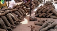
The major crops cultivated include food crops (maize, plantain, cassava, rice, cocoyam and vegetables), tree crops (cocoa, oil palm and citrus). In spite of agriculture not being done on commercial basis, most of the food crops grown are mainly to be sold for income and the rest to be consumed by the family. Tree crops such as cocoa citrus and oil palm are also grown mainly for commercial purposes.
Few of the agricultural produce are processed. These are cassava into Gari, maize into corn dough and oil palm into palm oil and palm kernel oil.
LIVESTOCK
Animal Husbandry activities range from large through small to domestic keeping of poultry, goats, sheep, cattle and pigs. About 80% of animals are kept under the semi-intensive system where the animals are allowed to forage out of their keeping places and return indoors later. All commercial poultry keepers however use the intensive system of animal rearing.
MAJOR AGRICULTURAL PRODUCE
The major agricultural produce in the municipality are:
Food Crop: 53.0%
Tree Crop: 25.5%
Industrial Crop: 01.5%
Poultry/Livestock Farming: – 19.5%
Non traditional enterprise 00.5%
Non traditional enterprise includes Black Pepper,
Pineapple, Beekeeping, Mushroom, Grasscutter and Snail
rearing.
FARMING SYSTEMS
The major farming practice in the district is mixed farming (90.1% of the farmers). This implies that, whilst the farmers cultivate the food and tree crops, livestock and poultry are also kept in the backyard as a supplementary source of food and income. The remaining 9.9% of the farmers practice mono cropping.
Considering the farming systems, bush fallowing, which is a system whereby a land is left for a period of time to regain its fertility is being practice by 48.5% of the farmers. The length of fallow period has been drastically reduced due to the growing population and the increasing demand for lands for uses other than agriculture. Continuous cropping is practiced by about 45.5% of farmers. This can result in lose of soil fertility and adversely affect output levels if measures are not put in place to retain the soil fertility in the course of continuous cropping. The other 6% of the farmers practice crop rotation.
Major Crops Grown in the Municipality
| Type of Crop | Output per season (Tones) |
| Maize | 5,400 |
| Plantain | 32,300 |
| Cassava | 81,200 |
| Rice | 1,632 |
| Cocoyam | 16,660 |
| Yam | 4,560 |
| Cocoa | 2,500 |
| Oil palm | 22,100.11 |
| Citrus | 16,970,54 |
| Pepper | 52.7 |
Top Ten Animals Reared in the Municipality
| Type of Animal | Total Stock |
| Sheep | 8,097 |
| Goats | 9,842 |
| Pigs | 11,100 |
| Poultry local | 118,198 |
| Poultry exotic | 501,000 |
| Cattle | 1,400 |
| Duck | 1784 |
| Turkeys | 92 |
| Rabbit | 56 |
| Grasscutter | 35 |
| Guinea fowls | 1273 |
MAJOR MARKETS
There are three market centres within the municipality where farm produce such as maize, cassava, plantain, maize, cocoyam etc and other products are sold.
| MARKETS | MARKET DAYS |
| Ejisu | Sundays and Thursdays |
| Juaben | Tuesdays |
| Boamadumasi | Fridays |


